About the area
'Land of the Fanns' is a low-lying area to the north of the river Thames, including parts of Greater London, Essex and Thurrock.
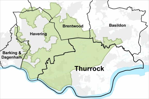
The landscape spans about 185 square kilometres (71.4 square miles) from Dagenham in the west to the outskirts of Basildon in the east, from Brentwood in the north to the Thames shoreline in the south. It includes Aveley, South Ockendon, West Thurrock, Purfleet, Chafford Hundred, west Grays, Bulphan, Orsett and Horndon on the Hill.
The natural environment is a river plain made up of the northern Thames-side marshes, fens and fanns, interspersed with low hills and ridges cut by local river valleys with their own marshes.
From the river it rises in geological platforms, known as the Romford Steps, to a range of hills that include – from west to east – the Havering Ridge, the Brentwood Heights and Langdon Hills.
'Fann' is a Saxon term for low marshy land or a low-lying district. The fanns and fann men were often recorded in local parish records during the 17th and 18th centuries.
For more about the area, go to Thames Chase: 'Land of the Fanns' local history.
Funding for the Fanns
In December 2016, the Heritage Lottery Fund confirmed an award of £1.35 million to the Land of the Fanns Landscape Partnership. With this award, the partnership worked on a 5-year plan to restore and celebrate one of the last landscapes of London. The total value of the programme is £2.4 million.
The areas of focus within Thurrock include Belhus, Mardyke, The Fanns in North and South Ockendon and Langdon Hills.
The programme offers local people the chance to get involved in a range of events and activities to improve understanding and help restore the local heritage.
Activities will range from travelling archaeology exhibitions to opportunities for learning new skills in natural, built and archaeological heritage.
Find out more about the Land of the Fanns Landscape Partnership and projects.
The outline map below shows Land of the Fanns in Thurrock and other boroughs.